Quiverheart Gorge
Trail Description
Address: 2199 State Route 781, Peebles, OH 45660
Download and Go! - Hiking Guide and More Information
A dog owner's guide to hiking the Arc of Appalachia
Everything you need to know before you hike:
You are entering a highly protected nature preserve. Regulations exist to protect the preserve’s natural communities from the impact of public visitors. Please follow these regulations to leave Quiverheart as pristine as you found it. Remain on trails at all times and walk in single file to protect the bulbs of native wildflowers bordering the trail - bulbs that are very vulnerable to soil compaction. Do not disturb, pick, or collect flowers, plants, rocks, or wildlife. Hunting, caving, fishing, trail biking, rock climbing, wading, campfires, and swimming are prohibited. Click here for a list of full regulations.
Dogs are not permitted at Quiverheart. Please see Hiking Arc Preserves for dog-friendly trails.
Address: 2199 State Route 781, Peebles, OH 45660
Directions: Quiverheart is located just off of OH-781 in northern Adams County, 4.8 miles south of Peebles. Travel 1.2 miles south of Peebles on OH-41 until you reach the four-lane OH-32, also known as the Appalachian Highway. Turn left onto OH-32 and travel 1.3 miles to the first exit. Turn right onto Steam Furnace Road. Stay on Steam Furnace for 2.3 miles. Steam Furnace will merge with OH-781 for a short distance, passing Toller’s Black Diamond Grocery. Stay alert and look for the entrance sign at the very next driveway on your right. Turn right into the lane and into the gravel parking lot. Signs will lead you to the trails. NOTE: If you miss Quiverheart’s entrance, OH-781 will soon split off to your left and Steam Furnace will continue straight.
Interpretive kiosk: An interpretive kiosk is planned but not yet installed. We encourage you to download the prepared trail guide and bring it with you to the preserve.
Trails are open year-round from sunrise to sunset. Note: Parking lots are not winter-maintained. Please stay safe by not hiking during trails during periods of heavy rain, ice, and snow. Also note that trails are closed during the annual deer management hunt which takes place on 1) the Monday through Sunday following Thanksgiving, and 2) the Saturday and Sunday before Christmas.
Difficulty - moderately difficult. Quiverheart’s two trails have been carefully constructed to provide a walking surface that is as level as possible, and a route that is assisted with bridges and steps. However, Quiverheart's terrain is naturally rocky, uneven, and steep, and the trail has many ascents and descents. This trail could be difficult for people with limited flexibility and strength. Safety Note: Trails have several creek crossings improved with either stepping stones or bridges that will be underwater during unusually high rains. Consider recent rainfall accumulations before planning a trip.
Trails at Quiverheart border dangerous, potentially life-threatening cliffs: Trails can be narrow, uneven, and steep, with some unimproved creek crossings. It is important to stay strictly on the trail and be sure to keep children close at hand.
Quiverheart Gorge’s Two Trails:
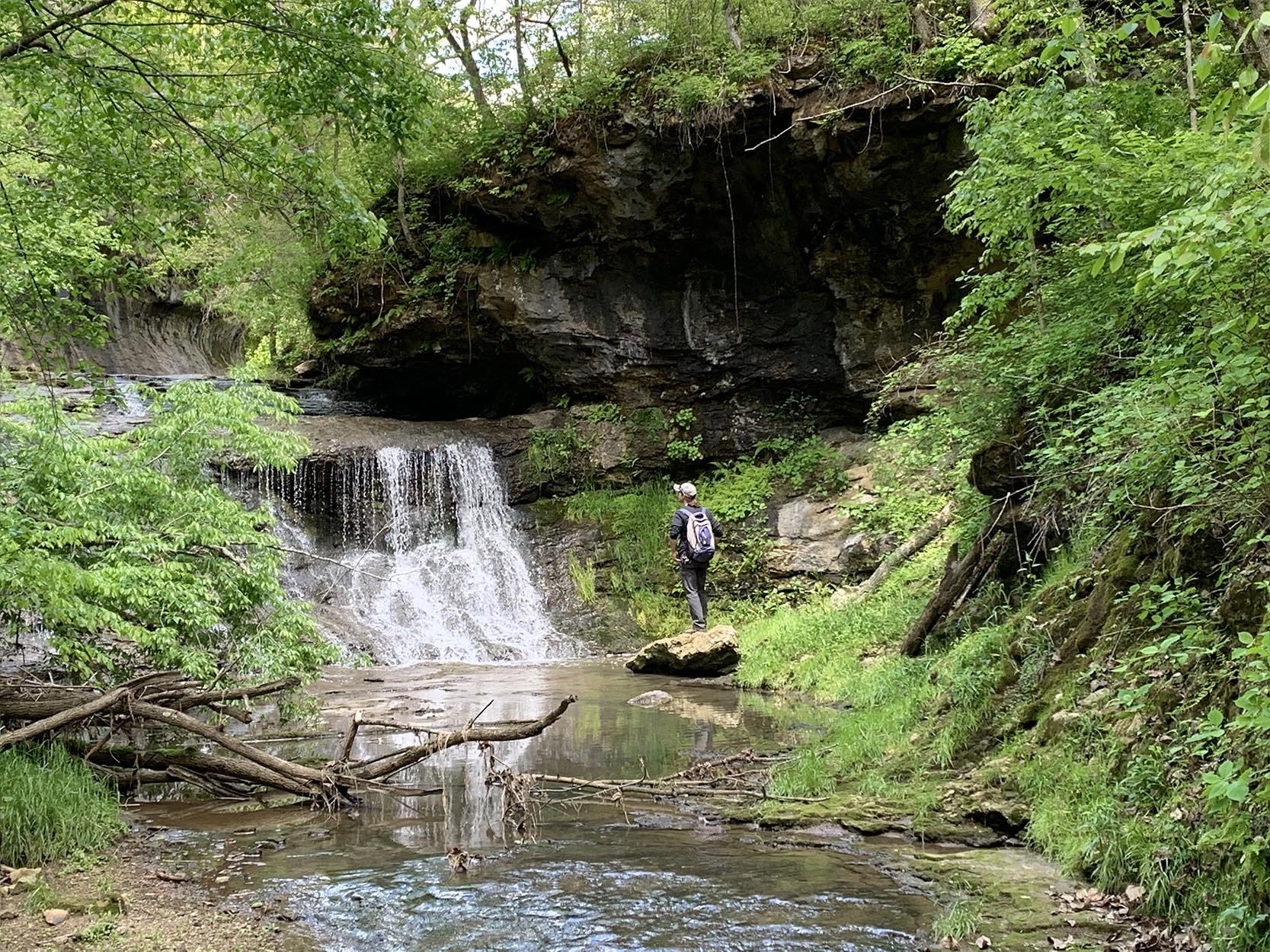
Quiverheart Falls Trail - 2.0-mile loop trail - The Quiverheart Falls Trail winds between the canyon floor and the upper rim of the gorge, offering hikers a variety of extremely dramatic landscapes. Memorable scenery includes a waterfall that is strikingly beautiful, db especially during the rainy season, a canyon floor densely covered with spring wildflowers, steep-sided gorge walls strewn with slump blocks, and a hillside of fallen rocks known as Boulder City. The trail also travels beneath a large rock shelter and along the cedar-clad rim of the canyon. From the bluffs hikers can admire the beauty of distant forest-clad hills and the deep shadow-filled valley of Bundle Run below.
Whispering Fern Trail - 1.25 miles loop trail- requires hiking the 2.0-mile Quiverheart Falls Trail to access for a total hiking length of 3.25 miles. - The Whispering Fern Trail extends the hiker's downstream journey along Bundle Run and into a remote side tributary. The trail travels below the cliff face, where more beautiful rock formations can be admired, and also follows the stream winding its way along the canyon floor. Spring ephemeral wildflowers grow in rich densities along sections of the wooded trail. Near Bundle Run proper are small cedar openings where remnants of a world-endangered plant and animal community grow - an ecosystem known as an Alkaline Short-grass Prairie, or simply, Cedar Barrens. Here one can see interesting wildflowers in the spring, such as Shooting Stars; and rare prairie wildflowers in August.


