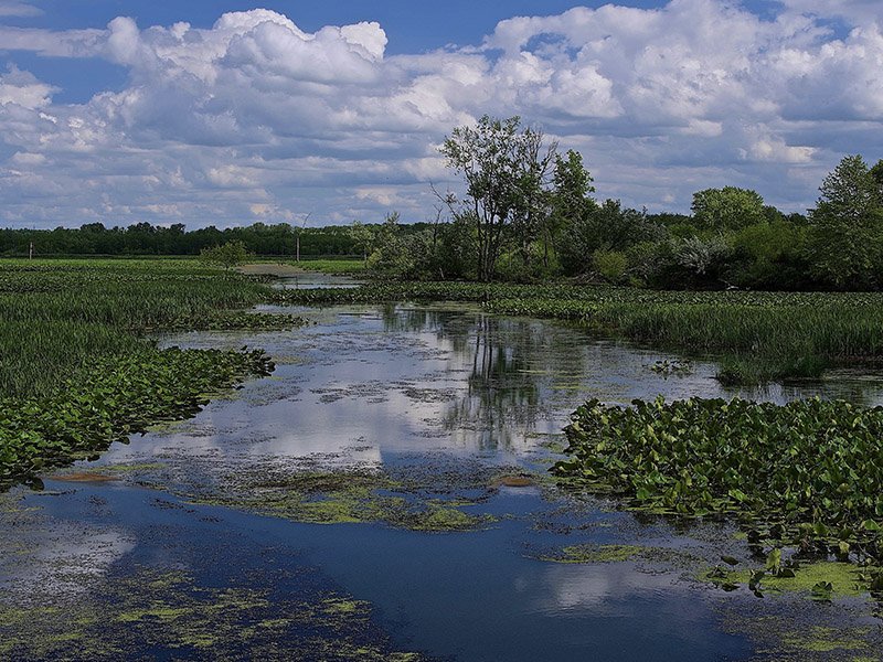
Killbuck Swamp
Trail Description
Address: Quarry Bluff Trailhead - 10114 SR 520, Killbuck OH 44637
Turtle Pond Trail - 205 W Front St, Killbuck, OH 44637
Download and Go! - Hiking Guide and More Information
A dog owner's guide to hiking the Arc of Appalachia
Everything you need to know before you hike:
You are entering a highly protected nature preserve. Regulations exist to protect natural communities from the impact of public visitors. Please follow these regulations to leave Killbuck Swamp as beautiful as you found it. Remain on trails at all times and walk in single file to protect bulbs of native wildflowers bordering the trail. Do not disturb, pick, or collect flowers, plants, rocks, or wildlife. Hunting, caving, fishing, trail biking, rock climbing, wading, campfires, and swimming are prohibited. Click here for a list of full regulations.
Dogs are permitted at Killbuck Swamp on a 6-foot leash. A dog owner’s guide to hiking Arc Trails.
Address: Quarry Bluff Trailhead - 10114 SR 520, Killbuck OH 44637, (Coordinates 40.49487 ° N/ 81.99198 ° W) Turtle Pond Trail - (Coordinates 40.49482 ° N/ 81.98702 °W) 205 W Front St, Killbuck, OH 44637
Directions: Parking for the Turtle Pond Trail is on the south side of County Road 621, just across the Killbuck Creek bridge west of Killbuck Village. Parking for the Quarry Bluff Trail is at the junction of County Road 621 and State Route 520 just west of Killbuck Village on County Road 621.
From Columbus: (Approx. 77 miles or 1-1/2 hours) From Downtown Columbus, merge on I-670 East toward the Airport. From I-670 near the Airport, take Exit 10 A-B using the left lane toward SR-161 Easton Way, then follow the arrows to SR-161 East toward New Albany. In approximately 10-1/2 miles, take Exit 46 to US-62 and then turn left toward Johnstown on US-62 East. Follow US-62 East some 58 miles through Johnstown, Martinsburg, and Danville to just before the bridge over Killbuck Creek at the Intersection of SR-520 and US-62 just southwest of Killbuck, OH. Turn North (Left) on SR-520 for 1 mile. The parking lot for Quarry Bluff Trailhead is on the Left (West) side of SR- 520 and County Road 621 (Front Street), just west of Killbuck. Turtle Pond Trailhead is 3/10th mile east of Quarry Bluff Trailhead on CR 621.
Interpretive kiosk: An interpretive kiosk is not yet posted at the preserve trailhead. Please be sure to download a trail map onto your phone before hiking or print this handout.
Killbuck Swamp’s hiking trails are open from sunrise to sunset. Please note parking lots are not winter maintained and the trails are not safe to hike during periods of heavy rain, ice, and snow. Trails are closed during our annual Deer Management Hunt which takes place on the 1) Monday through Sunday following Thanksgiving, and 2) Saturday and Sunday before Christmas.
Hiking Trails’ Difficulty - Turtle Pond Trail is an easy out-and-back trail. Quarry Bluffs Trail has a 200-foot change in elevation which makes it moderately difficult.
Killbuck Swamp’s Two Trails:
Quarry Bluff Trail - 1 mile loop - Quarry Bluff Trail is a little over a mile and ascends the ridge to an abandoned sandstone quarry with 200 feet of elevation change, making for a moderately difficult trail. The trail utilizes sections of two old quarry access lanes. These old roads were once fitted with narrow gauge rails on which the sandstone blocks were transported from the ridgetop to the road. From there the blocks were trucked a short distance to the stone mill in Killbuck. The Quarry trail now passes through mature woodland on its way to the now-abandoned sandstone quarry, and the sandstone exposed from the previous industry are now covered with moss and lichens. Great seasonal views are afforded from the top of the ridge.
Turtle Pond Trail - 0.3 miles - an out-and-back trail that is level and an easy walk. The trail borders Killbuck Creek and Turtle Pond just west of Killbuck Village. Once an access road to an active oil well, the lane has been repurposed as a walking trail and provides good birdwatching and other wildlife-viewing opportunities. Look for waterfowl and waterbirds that utilize the creek and emergent marsh. There is currently an active beaver lodge at the end of the trail in the middle of the marsh.


